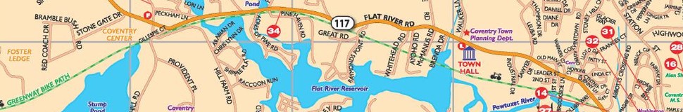


Coventry, RI Street Map
The most accurate Coventry town map available online.

On August 24, 1741, the western end of the town of Warwick had been purchased by Samuel Gorton, and others from Miantonomi. It was set off and incorporated into a township to be known as Coventry — named for Coventry, England. The new town extended from what is now West Warwick to the Connecticut line, and contained 64.8 square miles. Therefore it became larger than its mother town, but was more sparsely populated.
Early figures show that in 1748, Coventry's population was approximately 792. Several villages, originally built around mills, lie in the eastern section of town close to the West Warwick boundary. Today, while the western portion of Coventry is still rural in nature, the eastern section is one of the most rapidly growing residential communities in Rhode Island. However, the community still retains some old textile mill villages. The housing pattern consists of multi-family units in the older sections of the town, and owner occupied single family units in the newly developed areas. Commercial strip and shopping centers are the main commerce outlets.
Visit town website: http://www.coventryri.org
