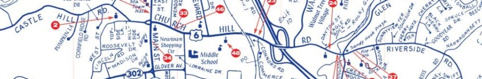


Newtown, CT Street Map
The most accurate Newtown town map available online.

Newtown is a scenic “small town” located in Fairfield County in southwestern Connecticut, about sixty miles from New York City. Newtown is bordered on the south by Easton and Redding, on the north by Bridgewater and Southbury, on the east by Oxford and Monroe, and on the west by Bethel and Brookfield. Newtown is traversed by Interstate 84, U.S. routes 6 and 302 and Connecticut routes 25 and 34. It covers 38,644 acres or 60.38 square miles, making it the fifth largest town, area-wise, in the state. Newtown was established in 1711 and is comprised of the Borough, Sandy Hook, Hawleyville, Botsford and Dodgingtown “neighborhoods”.
Visit town website: http://www.newtown-ct.gov
