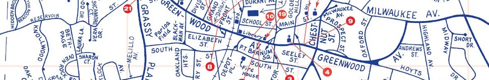


Bethel, CT Street Map
The most accurate Bethel town map available online.


The small New England town of Bethel, formed in 1855, is located in northern Fairfield County. Bethel lies sixty miles northeast of New York City and fifty miles southwest of Hartford and is accessed by state routes 6, 53, and 58 and Interstate 84. Its neighboring towns are Redding, Danbury, Brookfield and Newtown. A town of more than 18,000 people over 17 square miles, Bethel is served by a full time police force, two volunteer fire departments, and the David W. Deakin Educational Park, which contains five schools from grades K-12 and sports fields on one campus.
The town is governed by a Board of Selectmen/Town Meeting.
Visit town website: http://www.bethelct.org
